Geomatics & R/S

The Geomatics department was formed in 2018 when the country and clients needed specialized services of geomatics engineering sciences and spatial Science Technology Incrementally; it is the first time one of Iranian electricity consulting company places Geomatics department. This department boasts a group of academic and experienced experts in the field of Geospatial Information Systems, Remote Sensing, IT, and mapping; it has also started to work with the latest world science and technology in the mentioned subjects related to power, water, environment, etc.
Geomatics and R/S services
Designing and Developing Geospatial Extensions and Systems
- Designing and developing Geospatial Information Systems (structural studies of systems, Designing and Implementing data models in various levels (Conceptual, Logical, Physical), designing geospatial database, developing suitable user connector in the form of an extension or a software on the web platform (web GIS, Mobile GIS)
- Establishing safe and stable communication channels in order to exchange Geospatial Information in various data forms (XML, JSON, GeoJSON) and modern technologies such as REST
- Providing Geospatial-Based services to others inside and outside software and systems on platforms (Web- Local)
- Relying on OGC (Open Geospatial Consortium) Standards
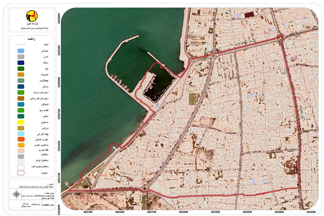
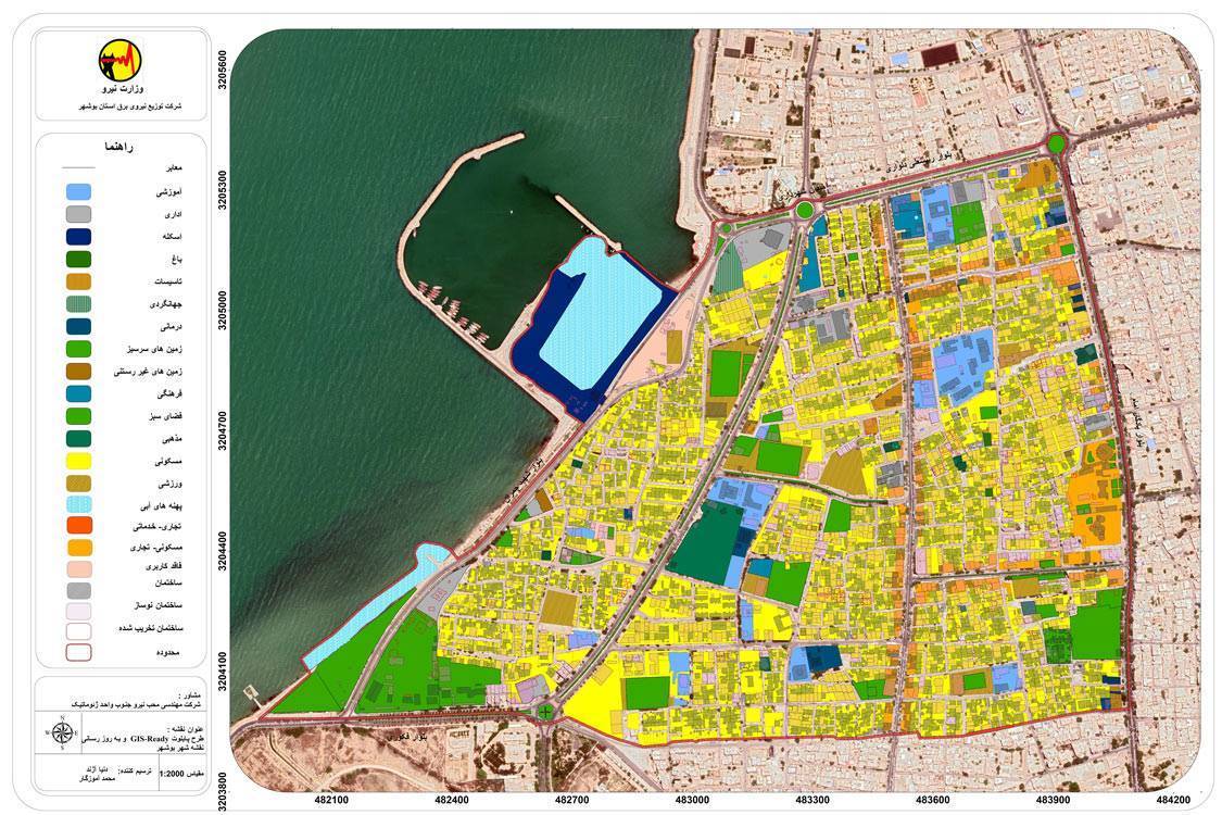
GIS Ready, Calibration, Updating and Upgrading The Base Maps Accuracy
This section is consisting of creating and standardizing cohesive Geospatial database from base-maps (Urban development plans Rural Guidance plans and etc.) and GIS-Ready map layers. Précising and Updating maps are done using satellite imagery and Orthophoto. Field surveying is also done by using various GPS.
Remote sensing
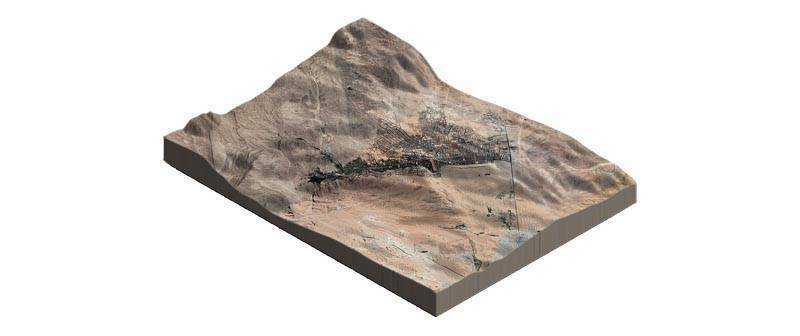
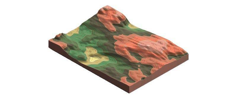
Resilience of distribution networks and structures against natural hazards is one of the most important concerns. Hence combining various information layers of modern Remote Sensing technology (Drone Mapping, Satellite imagery, and etc.), processing and analyzing in Remote Sensing and GIS platforms, properly can provide the appropriate solutions to upgrading resilience of distribution networks and relative structures. Adopting the right approach to manage crisis in designing and redesigning networks can effectively reduce costs imposed by the crisis to this industry.
Geospatial-based engineering services in Moheb Niroo company with technical knowledge possession and benefit from Specialists in this field, beside what has been mentioned before can provide others services. For instance, detecting changes, locating optimal routes, zoning map of crisis, hazards atlas in various scales, types of subject maps (LU/LC4, Vegetation, Land Surface Temperature, Soil Moisture, Waterway Network, Slope, Aspect of slope and Topography). Extracting Digital Elevation Model (DEM) using Drone and LiDAR systems are another service Moheb Niroo can tender to organization.
Developing Dedicated maps to organizations
A map concludes multifarious layers of different sources according to receiver services requirement is customized and will be launched on relevant organization server. Setting up a dedicate server and developing customized services from Base-map and present layers of organizations is one of the most important Geospatial information systems pillars in internal network platforms, web GIS and Mobile GIS.
Maintaining security and stability of dedicate map services because of reliance lack to overseas servers and systems, and ability to provide Online and Offline is another important issue in dedicate map service.
In these 2 years we have been able to handle related projects, timely. It means developing and designing Web Services using the update map which have been standardized and calibrated first and the client data by focusing what they need. Such projects were done in order to easy access and management. We also surveyed spatial and descriptive information of power network. One of the most important
Special Offer to Overseas Clients
We have decided to offer some part of our services for free at the first step. For instance, trying our ability in evaluating of exist organization status in terms of detecting its requirements of the organization and providing the GIS-Based solutions in above mention services. It leads to hold and do a part of the project as pilot for free, in the next step.
GIS ready Projects
The process of preparing data to be entered into the Gis system is called GIS Ready. This process also includes the operation of updating information, because usually changes will always occur in the real world after the creation of layers. In most cases, information is produced in DWG or DGN formats, and to use them, we must convert the data into the appropriate format or enter them into the database.
Comprehensive Network Vulnerability Atlas on GIS
Among vital and sensitive infrastructures, electrical energy and power distribution networks is more important than other vital arteries, not only in providing the basic needs of the human society, but also in the continued existence of other infrastructures that depend on reliable and stable electrical energy. The comprehensive crisis management system of each organization should be in a form that balances the available resources with the risks in case of any crisis so that the crisis can be controlled by using these infrastructures.In a completely systematic way, this requires new sciences and technologies that are able to direct the best management response to the implementation stage in the shortest possible time.
Design and implementation stages of Comprehensive Network Vulnerability Atlas are as follows
- Collecting, preparing and storing data required for zoning natural hazards and network hazards
- Compilation of natural hazards zoning maps, network hazards and Comprehensive Network Vulnerability Atlas
- Providing crisis management plan
Studies of Retrofitting for distribution networks
The vulnerability of all types of equipment and facilities used in the distribution network of the electricity distribution industry is an issue that becomes especially important during crises caused by natural disasters, war or sabotage operations, as a result, considering the importance of electric energy in maintaining and continuing the activities of society, it is necessary To take measures to reduce the effectiveness of threats and reduce vulnerabilities and strengthen the network
Natural hazards Zoning
- Floods
- Earthquakes
- Corrosion
- Erosion
- Landslide
- etc